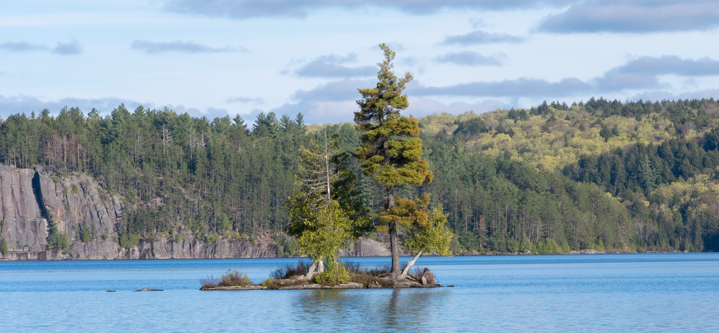
Summer has unfortunately come to a grinding halt! For Karen and I this means the end of camping season. For our last camping trip we decided to return to Wilmington Notch. We were here last year and love the area, this time we returned to also try out the fly fishing on the West branch of the Ausable river. The AuSable River is a blue ribbon trout stream due to the highly oxygenated water, great cover, constant water temperature, and generous supply of aquatic insects. The AuSable River consists of three main sections including the East Branch, the West Branch and the Main branch. The West Branch of the AuSable River is located in the Northeastern part of New York in the Adirondack Mountains. The West Branch starts with the junction of the Macintyre, South Meadow and Marcy Brooks and if flows approximately 36 miles northeast before it is joined by the East Branch at AuSable Forks, NY. It’s the West Branch that is known for the large trout. Some may go so far as to say it is one of the best eastern trout streams and it definitely has some of the best scenery.

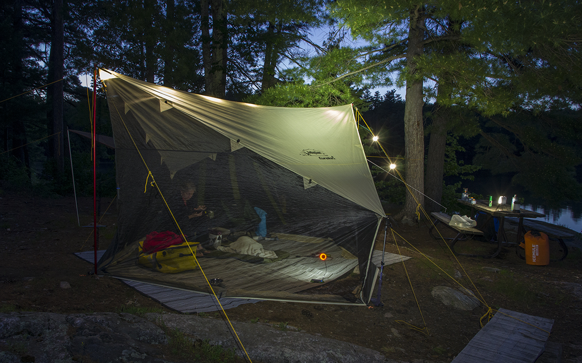
Last year we tent camped at the nearby State Park, and while it is a great location, we decided to “Glamp” this time around, and booked into the KOA (First time we have ever had full hook-up, including wifi and cable TV) Since we spent very little of our six days at the campground, we did not mind the lack of privacy and close quarters found in most privately run campgrounds, we prefer the space generally provided at most State/Provincial parks. The location could not be better, the campground has a trail that is a short ten minute walk to some of the best fly fishing in Eastern US.

Being September, the campsite was very quiet for most of our stay…picked up a bit on the eve of the Lake Placid Iron Man competition, with the arrival of a lot of Quebecers clad in their traditional spandex in every gaudy colour known only to a French man.

Karen and I spent the first day exploring the many trails and paths along the river, and stopping to watch the locals attempting to catch their trophy trout….not only did we not see anyone land anything, I too was to leave the region defeated…at least until next September (We plan on making this trip a yearly pilgrimage)

On the second day, armed with a selection of flies recommended by the local experts at “The Hungry Trout fly shop” Karen and I (without Marcus – he does not do well sitting idly while I attempt to catch trout) headed to a nearby stretch to attempt to catch lunch (This stretch of river is catch and release – so either way we were going hungry this day)

If you are unsuccessful on the river, you can always get your fill of trout at “The Hungry Trout” restaurant. We ate here last year and it was superb. This time around we had supper in the downstairs pup, again very good grub.


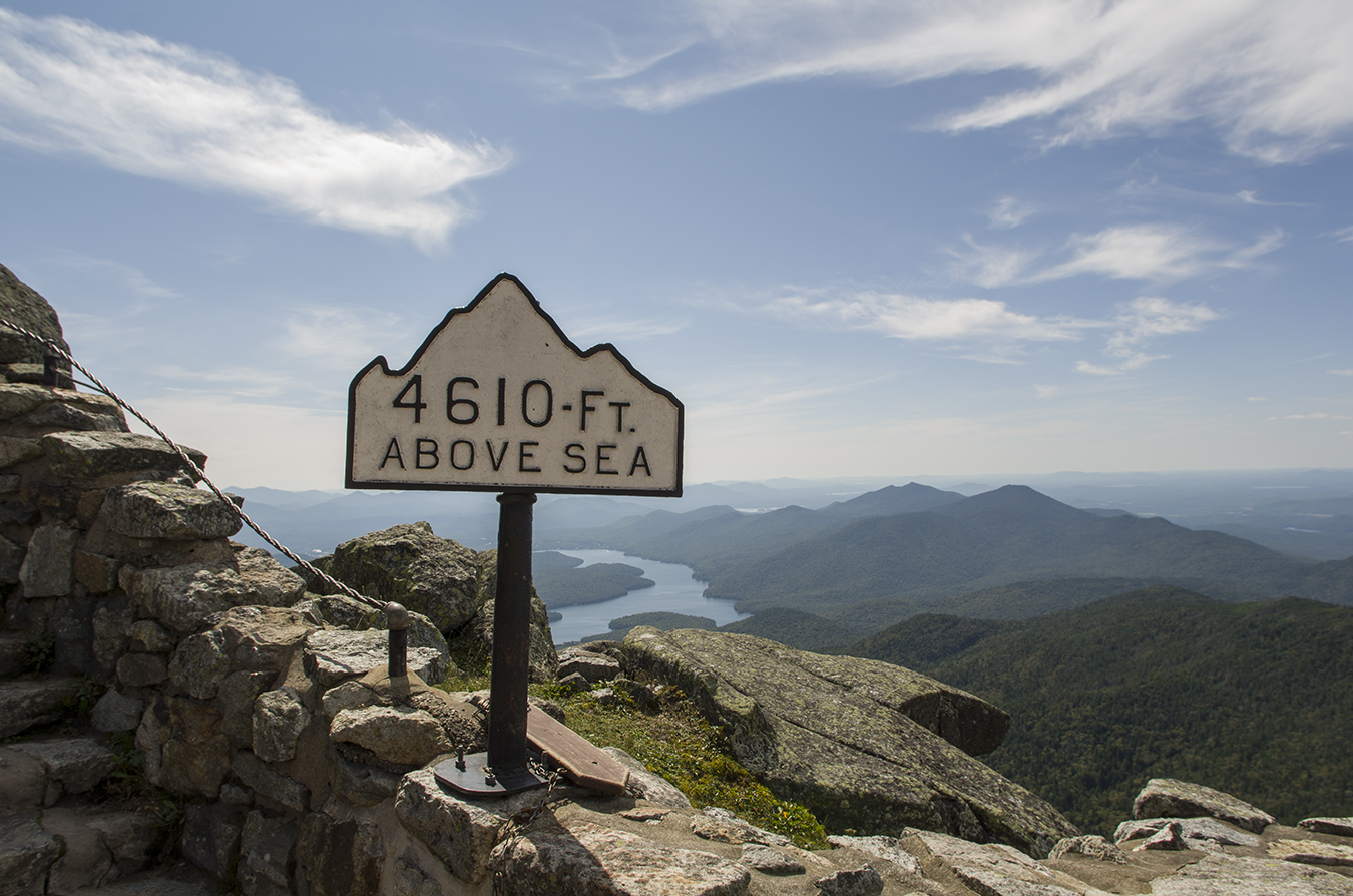
The next day was a beautiful sunny and clear day, time for our trip to the top of Whiteface mountain – Taking the Whiteface Veterans’ Memorial Highway to the top of Whiteface Mountain—New York’s fifth-highest peak at 4,867’—isn’t your typical automotive experience. How many other roads do you know that lead you directly to the summit of a mountain, with gorgeous views spanning hundreds of miles of wild land reaching as far as Vermont and Canada? (Hmmm maybe Mount Washington in New Hampshire)

Pre-dating the ski area by about 20 years, the road to the summit was dedicated by Gov. Franklin D. Roosevelt in 1929, and opened in 1936 by President Franklin D. Roosevelt. Natural wildflowers grow roadside, serving as a living museum of forest ecology, all of which is built upon the over one billion year-old Anorthosite bedrock boulders. Along the way up are nine designated spots where you are encouraged to stop, enjoy the views, and discover more about the mountain surroundings from the posted information signs. We had driven to the top of Mount Washington a few years ago, this road was far less exhilarating (much to Karen’s relief)


One thing that really surprised me, was how much of a hurry every one seemed to be, racing to get to the top. We did not see anyone else stopping at the viewing spots (Considering the cost of the toll it made no sense to me)

We had tried to do this trip last year, but the weather did not cooperate, in fact we never saw the top of Whiteface once due to cloud cover. This trip we had four days of clear and sunny weather.

There used to be an elevator cut deep into the rock, that took you from the parking area up to the summit, however it was being repaired and was closed. So took the very rough trail to the top instead, it was a lot of fun (Would not want to try it when wet)


This trail is not for the feint at heart, it was very narrow and rocky.


Perched high atop an iconic summit of the Adirondack Mountains, nestled among the krummholz and alpine tundra, and carved from the granite of the mountain itself, is a historically unique and state-of-the-art scientific research station. Known to locals as the Whiteface Observatory. This weather station is run by the University of Albany.


By this point Marcus was anxious for a really good hike (He had not been allowed to hike to the summit of Whiteface, and so stayed behind with Karen) We decided to hike to Owens Pond and then to do the Copperas pond hike the following day.


I guess hiking was not enough for our hound…once we got to Owens pond, he decided to go for a swim. Ever since the vet diagnosed him with thyroid deficiency, and he has been getting thyroid medication he has become so energetic, just like he was a puppy again. Both Karen and I are overjoyed at his recovery. The next day we took Marcus on the Cooperas pond and the Winch pond trail. This one was much steeper and harder going than the Owens pond trail, thank goodness for the cooler fall weather.


Our hike to Winch pond was not as scenic…not even sure it would classify as a pond!

Time to take a break from fishing and hiking. We decided to drive about and check out a few spots in the area. We stopped at most of the riverside rest areas and viewing areas.

We had a tourist map that claimed there was a world famous earth shatteringly amazing covered bridge nearby, so we headed to the thriving metropolis of Jay….


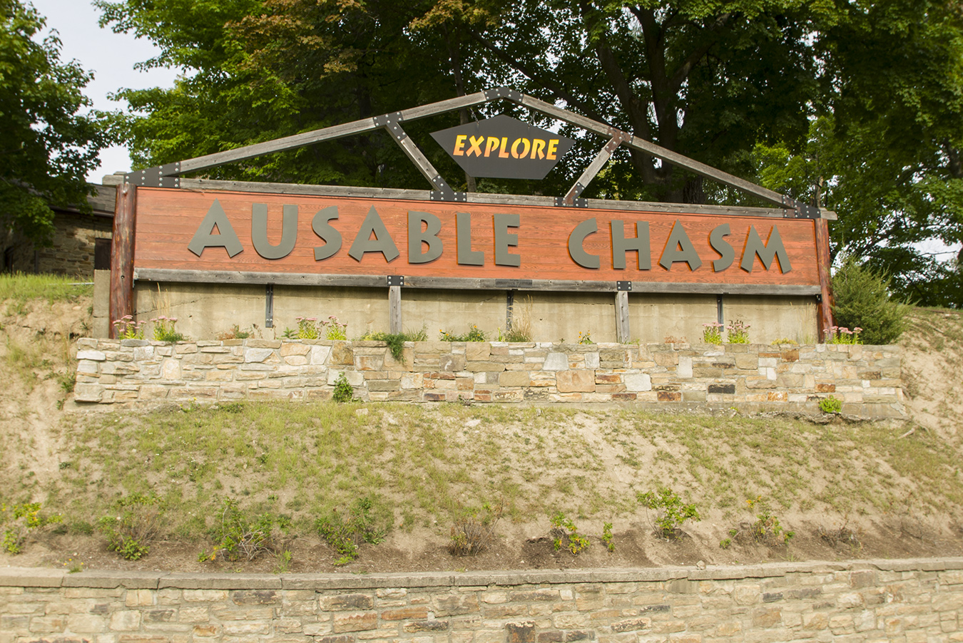
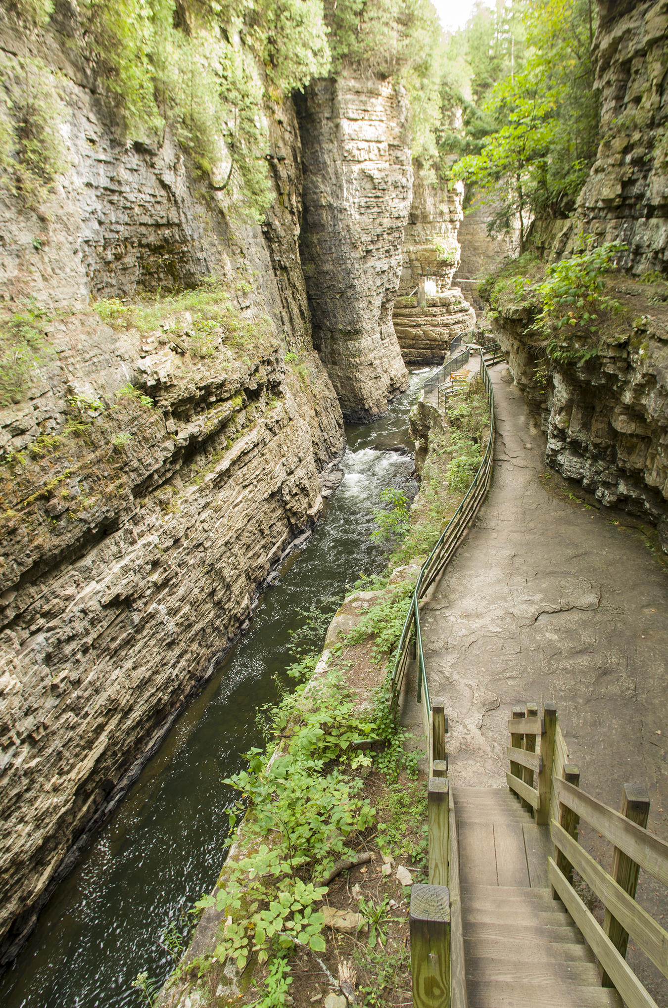
From the Hamlet of Jay, we headed east towards Lake Champlain, to take a look at the world famous Ausable Chasm..The oldest natural attraction in the United States (est. 1870), the sites of the chasm are breathtaking. Formed of sandstone that is 500 million years old from the Cambrian period. More than 10 million visitors have explored the chasm on the well-maintained scenic nature trails. Scenic vistas, bridges and stairs throughout provide stunning views of the chasm and amazing waterfalls. We had driven past the location a few years back enroute to The White Mountains in New Hampshire, but had not explored the trails.

Something to note here is that the admission rates here are quite high, so come early to be able to take advantage…We showed up about an hour before closing so were unable to walk as many of the trails as we had hoped. We will return again and perhaps try out the Adventure trail..Strap on a harness and explore the Family-Friendly Adventure Trail, a region of upper Ausable Chasm that is not accessible from any other trail. Crisscross over the raging river on this fully-guided, unique via ferrata that features cable bridges, a cargo net climb, and edge walks. A via ferrata is a protected climbing route characterized by a steel cable that runs along the rock, offering a unique and awe-inspiring journey through the chasm.


We had finished one of the trails, when we realised we would not make it back to where we had parked the truck by closing time..so we ended up having to exit and walk along the highway…My recommendation would be to put in single direction turnstiles to allow you to exit after the gates are locked..I don’t think Karen would have wanted to camp out for the night.


Six days came to an end far too soon, especially since we have to wait a long nine months until camping season next year. We had a great time exploring the area, and look forward to returning to the Lake Placid KOA again next year.

Reader Comments
Great to read see you soon xo
Next week…wow time flies, see you all soon.
What a trip! Looking forward to seeing the two of you a week today. Your Father will meet your flight. Safe trip and lots of love! XX Mum
Thank Mum…looking forward to seeing both of you soon….